TntConnect TM
Helping you build powerful connections for a lifetime of ministry...

How can I export my partners to a GPS?

TNT.tips from Bob!

Table of Contents

It is our pleasure to provide this software free of charge to help you in your ministry.  We're so thankful for our partners who make this possible!

About TntWare

Page Details

First published by:
Troy Wolbrink
on 7 Jul 2011
Last revision by:
Troy Wolbrink
on 10 Oct 2013
This page has not yet been rated

How can I export my partners to a GPS?

Filed under: [Edit Tags]

TntMPD 3.0 Update

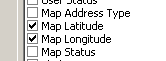
Now that TntMPD allows you to export geographic coordinates, you can "File | Export Current Group" (and be sure to include the "Map Latitude" and "Map Longitude":


A free Windows program called POIEdit can import this file and update your compatible GPS.  If you find a Mac program with similar capabilities, please let me know!

Using Microsoft Streets & Trips

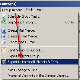
There are many ways to do this, but one way that's quite easy in TntMPD 2.1r66 is via Microsoft Streets and Trips 2011.  You can lookup your partners in TntMPD (under the "Lookup" menu, click on "Newsletter Recipients", for example).  Then under the "Group Actions" menu, click on "Export to Microsoft Streets and Trips":

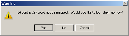
This process will export all the deliverable mailing addresses (home, business and/or other) for all the contacts in the current group.  It will exclude any "P.O. Box" addresses or any addresses marked as undeliverable.  This menu will launch you into Microsoft Streets and Trips, and when you return you are given the choice to lookup all the contacts that didn't have a mappable address to export:

Within Microsoft Streets and Trips, you might be prompted to verify and match a few addresses:

Take note of this process.  It may suggest a more accurate or standard address to use for a contact.  If so, you might consider updating the contact's address in TntMPD to avoid future confusion.

After all the contacts have been matched, I'd suggest you remove any pushpins that aren't accurate down to the Street Address level.  You generally need more accuracy than the middle of a zip code to find your partner's house!

Double-click on the set of Pushpins on the left pane:

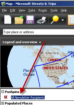
Then, under the "Matching" tab, sort by "Matched status" by clicking on the column header.  Select any that are not "By Street Address" and then right-click and "Cut" to remove those pushpins.  Only those with "By Street Address" should remain:

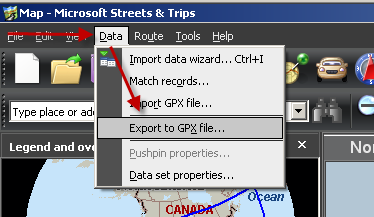
Click "OK", then under the "Data" menu, click on "Export GPX file":

 This will prompt you to save a ".gpx" file on your hard drive.  Remember the location and name of the file you provide.

For my Garmin, I downloaded a program from their website called "POI Loader" (http://www8.garmin.com/products/poiloader/).  I plugged in my Garmin GPS unit to the USB cable on my laptop and ran this program.  I told it to load the GPX file I just created from Microsoft Streets and Trips.  After a few seconds, it said that it was successful.

Now when I have my GPS in my car, I can find partners nearest me, call them w/ the phone number provided, and have some basic MPD info provided as well!

Here's a little demo of how it looks on my Garmin GPS:


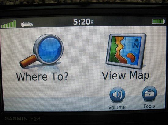
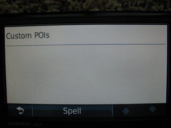
Notice how it shows me my partners in order of who is most close to me at the time:

 
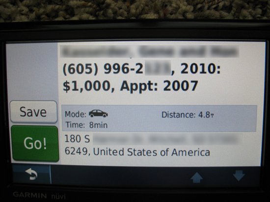
What's nice about this, is that I can see who's closest to me.  If I have time to visit, I can call them and tell them at I'm "in the neighborhood" (because I literally am).  If I click their name, I'll see more details.  The partner's name is on the first line (all blurred out).  I can see their phone number.  Also I can see that their last gift was in 2010 for $1000, and that we last met on 2007:

 
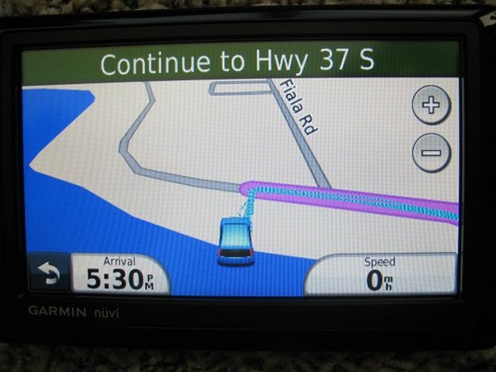
When I call them, I can tell them I'll be there in 8 minutes.  Then click the "Go!" button:


Recent Comments

By: Darrell Ash Posted on 8 Jul 2011 7:59 PM

Sounds great! Can it be done w/o purchasing Msoft Streets & Tips for $25?

By: Dave Damien Posted on 8 Jul 2011 8:12 PM

Will it work with the Streets and Trips 2011 60 day trial edition?

By: Troy Wolbrink Posted on 15 Jul 2011 6:06 PM

Yes, it works with the Trial edition of Streets & Trips 2011.  Hate to mention it, but that's what I've been working with all summer.  Most of our support trips don't last more than 60 days, so we might never actually buy it!  I'm sure next year I'll update TntMPD to work with the 2012 edition as well...

By: Sus Schmitt Posted on 17 Apr 2012 5:05 PM

Would PoiEdit be a good option (www.poiedit.com/compatibility.htm)?  It works with Google Earth and with Excel instead of being tied into software like Streets & Trips.

PoiEdit asks for a donation.

By: Troy Wolbrink Posted on 20 Apr 2012 6:32 PM

Maybe, Sus.  Although I found the Streets & Trips route pretty easy.

By: Steve Posted on 15 May 2012 2:18 PM

Did you delete this option? I have 2.1 r81 & do not see the option to go to export to street & maps under group actions.

By: Troy Wolbrink Posted on 19 May 2012 12:53 AM

@Steve,  What version of MS Streets and Trips do you have installed?

By: Steve Posted on 22 May 2012 5:12 PM

I am all set, I did not have MS Streets & Trips installed on that computer.  Once installed I could see the export under Group Actions.  Thanks - looking forward to using for our summer trip!!

By: Michael Drackley Posted on 12 Jul 2012 2:23 AM

I've upgraded to MS Streets & Trips 2013... The "Export to Microsoft Streets and Trips" has disapeared.  Is there something I need to do to get it back?

By: Troy Wolbrink Posted on 18 Jul 2012 9:11 PM

I'll have to update TntMPD to support this newer version of MS Streets and Trips.  For now, the only solution is probably to install an older version of it (2011).

--Troy

By: MarkDavis Posted on 10 Oct 2013 7:42 PM

POIEdit works great for probably any GPS if you want to do just a tiny bit of work.

I just used TntMPDs “mapping details” export to Excel capability to create an Excel spreadsheet of all of my MI supporters with their Lat. and Long. coordinates.  I then saved it as a CSV and imported into POIEdit.  I then used POIEdit to convert it to a TomTom POI DB and copied it to my Tomtom.  I now have all of my Michigan supporters in my Tomtom by name and can get directions to any of their homes on my GPS!

By: David Clow Posted on 22 Jan 2015 4:53 PM

Microsoft discontinued both Streets & Trips as well as MapPoint on 12/31/14. www.microsoft.com/.../MapPoint-alt.aspx

I tried to follow MarkDavis' instructions above but seemed to miss something: I exported TNTMPD data (name, lat, long) into a csv, but POIEdit would not read it without errors.

2 questions:

1) has anyone found a way to use Bing Maps, Google Maps or some other updating mapping system to associate TNTMPD contacts with actual street addresses on a map?

2) Can you supply me with the missing steps needed to use POIEdit?

© 2024 TntWare, Inc. | Privacy | Terms of Use